Monday, August 31, 2009

Kakariki on Titi

I seem to be in constant catch-up mode on the blog. This last weekend was another one in the Tararuas. Just a meander and chow up onto Cattle Ridge and down and out over Blue Range. I will write it up when I see the photos.

Whats been up otherwise though? The usual mix of work and meetings and muddling around and getting out and about to cool places. Caspar and I did Karapoti a few weeks ago. The famous mtb loop. It is a merciless, unrewarding grovel. But good fun all the same, though don't be expecting any views (Hey Caspar send me some photos!).

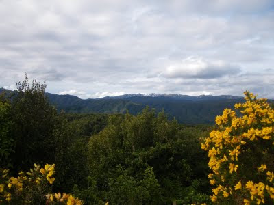
Well ok, there might have been one spot with a view. North to the Tararuas from the top of deadwood

Sometime around there we had another beach clean-up which we finished off by making little houses for penguins. Penny got a bit excited and thought the house was for her...

And not so long ago Penny and I had a nice little mission into the Western Akatarawas via the Maungakotukutuku road end. We decided to climb a little hill called Titi. Judging by the Maori names we were expecting to see a whole lot of muttonbird on a mountain of fuschia, and although in this we were disappointed we did see some very cool kakariki, our native parakeet, playing around in a tall lemonwood tree which was pretty cool.

In fact this entrance to the Akatarawa's has much going for it, and not only for the dirt bikers which abound. It is adjacent to the only DOC managed reserve in the area, and the forest is fantastic, with myriads of tracks to keep you interested.

Wednesday, August 26, 2009

Maori at Dusky Sound

I have been doing a little bit of research recently on the history of Dusky Sound. Lots of crazy characters and interesting stories. I love this image of Maori at Dusky Sound. Academics tend to talk of Maori intrusion into some of our more wilder places as a seasonal thing, and this can be true, as in regards to say muttonbirds, but I am quite interested in the idea that human population movements may have been "plagues", in the same way as we consider other invasive species today.

Sunday, August 16, 2009

Tararuas Main Range

A couple of weekends ago Penny and I and Jonathon Kennett stretched our legs around the Tararua main range loop from Otaki Forks. It was a gem of a weekend.

I was keen to avoid the grunt up past Field Hut to the main ridge having done it a few times before but Jonathon vetoed my alternative route of Plateau Stream and Pakihore ridge. He was right, it wasn't a weekend for bush-bashing. It was just down right beautiful and pleasant cruising up through the low forest then slowly gaining the sunny subalpine country, gazing at the views north and south. I spent my time wishing I knew about the different species of Olearia and looking for shortcuts to take in the next Tararua Mountain Race.

Penny chose a great lunch spot, the summit of Bridge Peak over looking the headwaters of Penn Creek and looking further north to the main range we were to Traverse, and in the distance the bulk of the Northern Tararuas, which will have to be a future weekend or two. A glider swooped us, much like last time we were tramping up here several years ago with Andrew Thompson.

Back then we stayed in the Maungahuka Hut and this was our destination this time as well. Although since 2001(ish) the hut has been replaced, to a nice new "boutique" hut, much to the dismay of the miserable Tararua hard core kill joys!;-). The traverse from Bridge Peak to Maungahuka was fun, even if a little sunny and sleepy. It felt at one stage as we sat on the summit of Maungahuka itself like we were in the sleepy fields of Wizard of Oz and were about to be set upon by a gaggle of munchkins.

The night was chilly, in fact freezing, and the new hut has a severe ventilation problem which seems to have led to a puddle of water on the top bunk. When we woke our side of the ridge, the leeward, was frozen over, though for some reason not the tarn. We left the hut quickly and it was up down, up down, traversing over a few steep little knobs on the ridge. A detour down to Aokaporangi Biv (great spot!) saw us climbing this great big rounded hill twice, but by now the temperature was starting to warm up, and the little hogs back that had formed on the ridge overnight had dispersed.

Entering the bush ridge leading up to Andersons Memorial Hut was such a pleasurable experience I had to do it twice, it was the sudden change from open tussock shrubland, around a corner and into a hallway of silver beech goblin forest, open underneath, twisted brunchs and clumps of moss hanging from the ceiling like the ancient banners of warring kings. It wasn't far along this ridge unfortunately and Andersons Memorial hut became our lunch spot.

Leaving the hut we heard a distant cooee, and were surprised when it wasn't Jonathon who had disappeared up front. We were even more surprised when after maybe an hour when we approached Junction Knob we found Ramash who had run in to meet us. His cooee had somehow travelled kilometres across the slopes of the range. Interestingly he had also been able to see my favourite high vis top from several kilometres away. Safety in the hills I'm telling you!

The descent to the Otaki took a while, 1300 metres or something straight down, and our stay in the rainforest in the vicinity of Waitawaewae hut was all too brief as we still had to get out and were running out of light. I was surprised how bad the track was from here, for a walk local to Otaki Forks, and as it got dark we were still ploughing down saddle creek. Torches out though and it was some keen, but sated trampers that arrived back in Otaki Forks after 12hours on the go. Great weekend, can't wait to get back in there!

Aoraki, a few photos of the cloud piercer

The other morning at the end of our holiday down south we drove back from Wanaka to Christchurch via the McKenzie Basin. I spent the first four years of my life in these parts and it has remained very special to me. It is the best drive in the world, over the Lindis, then past Omarama till Aoraki appears at about the same time as you pass the Salmon farm. We struck it lucky this time with sunrise and a few tunes of Dire Straits to add to the atmosphere...

Thursday, August 13, 2009

Some Ski-O Photos

top heavy on skis

Sam Kane - The secret of our success

Matt and La - champions again

Ski-O happens once a year in New Zealand. July sometime on the Waiorau Snowfarm - Pisa Range - Wanaka. We try to get there when we can. Fortunately there are not many good ski orienteers in New Zealand and Penny and I are occasionally able to slip onto the podium...a particularly worthy achievement in my case as someone that can hardly stay upright on ski's - though I'm slowly getting better with a practice day most years!

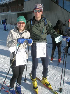
This year the format was a three hour teams event. We teamed up with ski-o first timer Sam Kane, a cousin of Penny's who farms the Glenfoyle station near Luggate. It quickly became apparent Sam was the star of our team and he became the official check point visitor while we preceeded to cut as many corners as we could. Matt Scott and Lara Prince were our major rivals, well major stumbling blocks to success. With their North American and Swedish cross country skiing backgrounds they basically blew us away. But through sheer perseverance, courage and cunning we did hold onto second..

Wednesday, August 12, 2009

Belmont Trig

When our flight was cancelled a few weeks ago, throwing our holiday plans into a kerfuddle, we made the most of our first day by again visiting Belmont Trig, one of the most special places in Wellington. I just love the aesthetics of the place, the trig, the rocks, the swathes of Horopito and the ridges and veins of the land sweeping down to our capital city.

Ahuriri

The first time I ventured up the Ahuriri it was still owned by old Williamson, though little did I know it. The legendarily foul tempered old cocky would not have been impressed at my 1984 Ford Sedan that bumped and battered its way all the way up to Shamrock Hut. We were stuck, or at least hindered many times, and the girls were generally happy to jump out on any particularly nasty stuff. The gang was Aaron, La and me, with Sofia and Kajsa from Sweden. We were just starting out on a memorable road trip which included being attacked by big mother kea in the Matuki, Copland flat hotpools and finally running out of gas way down south of Haast. That may even have been the first time I camped on the fantastic Neils Beach where the mighty Arawhata meets the sea.

Looking out the Ahuriri 2009

The long and wild Ahuriri was new territory for us, and it really is a quick path to wilderness. Find the turn off south of Omarama before you rise over the Lindis and before long you are off the beaten track. That first trip I think we stayed at Shamrock Hut though I remember a fire outside, and the next day we climbed point 2038 on the Eastern side of the valley and introduced the Swedes to scree and rotten NZ mountain tops. I remember not wanting to go to the top because of the danger to all concerned, then watching them go, before joining them at least with my conscience clean if someone got damaged, which very nearly happened.

The next trip was with Aaron again and his Mum Viv, we just went for a poke around Canyon Creek in the middle of winter, going straight up the gorge we discovered the high track on the way back. This time old Williamson caught us on the way out, and we pleaded ignorance and raved about how beautiful his station was.

Returning recently not much has changed, although there is now a locked gate before Canyon creek preventing 4wd capers. Birchwood station was bought up by the Nature Heritage Fund and the whole area is now known as Ahuriri Conservation Park. Again we returned in winter, this time it was Penny and I with our friend Elo. With Elo's sprained ankle and other plans it was only to be a short trip, a little pop over from Ahuriri Base Hut to the Upper DingleBurn.

Penny, Elo and the Spaniard

Although an old bulldozed musterers track takes you most of the way up, an ice axe was necessary on the last steep section. The snow just held our weight. Down the other side and into the Dingleburn, a river I have long heard speak of but never entered, the closest was an ascent of Dingle Peak from the Lake Hawea side. The top Dingle hut is on the bush edge of some big flats and looks downriver where the sun was setting on the ridges leading over to Dingle Peak. Early rain lead to a nervous night as we pondered our short but potentially difficult journey back over the pass in new snow. As James K Baxter describes we "rested fitfully", "Besieged by wind in a snowline bivouac".

Penny on the pass

Fortunately it always sounds worse at night. We made it back over the next day in light snow and the potential for avalanches while there wasn't too bad, maybe. A moment I remember was on the top of the ridge when the wind suddenly changed. One second northerly wafting in snow, the next second a crisper southerly blowing it away. Mountains do strange things to the weather. We decended quickly through the hare infested park like forest, safe again on the valley floor.

Looking down the Dingleburn

Monday, August 10, 2009

Milton

We found some great light in Milton the other day...

Tuesday, August 4, 2009

Red Gum - I was only nineteen

Classic protest music, 1983 looking back at the use of Agent Orange in Vietnam

Monday, August 3, 2009

Silverpeaks revisited.

As a kid growing up in Waitati I always longed to head into the Silverpeaks which I knew existed somewhere up behind the old shell station on the main road. We glimpsed them everytime we went over the Kilmog. I always tried to see "the gap". A prominent feature on the ridgeline above the Waikouaiti river. Later the first time I walked through the gap, was with Ben Powell, we must have been about 16. Up gap ridge and down bashing through the tussock to ABC cave, then the old jubilee hut. I visited this hut many times during my teens, so now they all blur into one. It was everything a hut should be. Shady, old and full of history. You could smell the latter growing on the mattresses.

And there were only a few rats, it wasn't infested like the notorious yellow hut, or the ancient possum hut. Their footsteps running and jumping in the night still exist in my restless dreams, or when I am tossing or turning in a hut full of wood smoke, like last week in the Ahuriri. I remember I went through a stage of carrying an old camp oven around tramping, and the old fireplace at Jubilee was the scene of at least one successful roast dinner. It wasn't often we found other people in there. Once we bumped into Bronwyn Strang, sister of Jim Strang who I was acquainted with only through Dad's copy of "Jannu: Wall of Shadows" my favourite mountaineering book growing up.

The Silverpeaks perhaps isn't for the faint hearted, on the only other time Penny and I have been in there together we found a tent washed down the creek. Then in the hut book, there were pleas for help from a lone traveller who had failed twice to find her way out of the deceptive ridge and valley systems. Just this May eight people were airlifted outin what sounds suspiciously like a University tramping club trip, while in the past there have been fatalities.Though I get the sense some of this aura is protected by the local powers that be, as in key places the track is not well-marked and user friendly routes have not been developed. In short the whole place is exactly like it was probably 50 years ago...fine by me, but expect people to get into trouble when this is the only tramping location on Dunedins doorstep!

We headed in from Double Hill Road, it was only intended to be a short walk, but as we sat down at the old Green Hut site and I bashed around looking fruitlessly for water, Penny got a call on her cellphone that our planned engagement was cancelled and we were free to roam. Up past Pulpit Rock and the painted forest sat there, a plane of green with the Maniototo skies behind.

Curling around the Silverpeak trig we forged through snow to the top of the Devils staircase. the new Jubilee Hit could be seen down valley on a high terrace, which I remember ploughing through the tussock of en-route to watch a falcon at its nest. The old hut satin the shade at the crook of the valley.

The gorse is still hanging in at the bottom of the Devils staircase. One thing you notice in this icy part of the world is the slow rate of revegetation, the forest may return in a couple of hundred years or so, but to the naked eye there is a permanence to this place to equal that of Dunedins fading city centre. I point out to Penny the easy step across the creek from rock to bank, where once, fully laden, I had fallen back in my youthful weakness. It won't be long I guess before it will be a big step once again. The last steep grunt up to the hut is worth it. I could certainly spend some time here in the sun, but today regrettably only a quick lunch was on offer.

With time just on our side we decided on a route out via ABC caves and Rocky Ridge, but first it was down and through the forested glen of Silver Beech to the old hut site. I now officially feel like part of history. A sign declares it. And the stone chimney remains. I learnt to build hut fires in that chimney, with wet smokey wood, scraps of paper and my old camp oven squashing the lot - probably before the fire even got going! I can see the woolen socks hanging beside the fire and the upturned boots shoved so close, and dried so quickly that the soles cracked away from the boot. Haha classic.

From the hut site you can still follow the old shortcut that leads up towards ABC cave. The 4WD track you join is steep and fast before it peters out in a wall of tussock. We looked back, to the west, down Christmas creek to the Lammerlaws, where Anton Oliver, Brian Turner and co are/were fighting their battle against the wind farms

We were getting worried about daylight, so shot through ABC cave, and its great sleeping platform and up through tussock to a high point, finding ourselves just behind the gap, less impressive from this angle. To the north the catchment of the South Waikouaiti rolled away from us in a series of ridges and the odd volcanic point. The ridge on the horizon is the Kakanui's, always obvious from the Dunedin hills on a clear day and site of another potential windfarm.

Our route from here was back via Rocky ridge to the Silverpeaks and with this track not been familiar or offically marked we continued to share some concern over darkness overtaking us. It was sweet as though. Years of use has worn a pleasant track typically, especially on the more defined ridges. And it was beautiful in the sunset with the light glowing over the little communities of Blueskin Bay to the left where I grew up, and the golden tussock of the Silverpeaks and their rocky sentinels heightening the aesthetics. Before we knew it, and with just a little twang of crispness in the air we were back past Pulpit Rock and the Green Hut site to Semple Road and the rental. Great day out in the Silverpeaks.