Friday, October 7, 2011

Escaping Kanchenjunga

This title is perhaps too dramatic, after all we were enconsed rather than imprisoned in the potato field village of Ghunsa. We had also heard that parties had successfully descended the Ghunsa Khola as far as Lelep. Rob and Claire, the kiwis we met in Foley, had passed that way but not without witnessing a significant rockfall in the gorge. Rob was even hit by a rock ricocheting from the other side of the river. So we knew it was doable, but the thought of retracing our steps back over all those slips and under those cliffs just wasn't appealing so we decided on the high route to the east over the five thousand meter Mirgin La with a chance to visit the south Kanchenjunga base camp should the weather be more amenable. Five days perhaps we figured back to the road end at Taplejung.


Rob and Claire and us - a meeting of kiwis in Foley


Day 1: Mirgin La

After final farewells at Ghunsa we wandered south down the mainstreet, passing the school and health post, and then the hydro scheme before climbing sharply into the mist towards the Selele La. The mist cleared briefly for us at one stage so we could look down on Foley, the rectangular shapes of the buildings creating some order amongst the chaos of the old boulder field in which it is situated.We could also briefly look back and see the small peak GB and I had climbed a few days ago


Selele La is a gap on the ridge rather than a true pass and we reached here without too much trouble. After this the weather gradually deteriorated until just before Mirgin La it began snowing. Our worlds were circumscribed first by the rims of our umbrellas, second by the drifting mist. Outside this bubble we heard rockfall, felt thunder vibrating and saw brief glimpses of mountain sides and lakes.


Right on the Mirgin La we met a fellow traveller, a Spainard, coming the other way with his guide. A quick yarn in the middle of nowhere with a kindred spirit. On the other side of the pass it got colder and windier, we weren't equipped for this, and we kept pressing on, stressed by the cold and wet, until we found shelter beside a small tarn just above Tseram. When it rains we must rely on our memories as the camera is to precious to risk.


Day 2: Kanchenjunga South

Incredibly the day dawned clear and we were off, outta  here like bald men towards the glistening peaks. The trail climbs to the left of a vast lateral moraine up the valley, a chossy gravelly snake. We walk on grassy basins past picturesque lakes and the seasonal yak herding settlements of Lapsang and Ramche. Always above us the mountains grow, the triangular profile of Rathong we skirt to the left exposing its summit ridge and the bishop shaped pinnacle near its summit.


Gradually Kanchenjunga comes into view, including most of its seven summits. To its west though I am taken by a huge ampitheatre of fluted peaks, none of them named. Scrambling past Oktang we crane our necks for a view of Jannu but see only its massive shoulder. Below us here the moraine wall drops sheer to the cratered glacier. What a spot!


We retreat reluctantly, chocka with beauty, chinese biscuits and the apples GB carried from Gyabla to treat us with. I was a little ahead of the others when I was first surprised by the "Humph", a quick outburst of air by something large. I crouched and it happened again, the big herd of blue sheep was just 50metres down valley, watching me. Several sheep sported the huge curving horns they are famous for and which can weigh 20kg each. We watched and followed them for ten minutes, so fantastic to see them holding on here, providing prey for the solitary snow leopards.


Wednesday, October 5, 2011

Blue Sheep

Ok, well we did see blue sheep, both on the side trip towards Nango La, and (heaps) up around Oktang on the way to Kanchanjunga South basecamp.


The key question though is who is the most likely blue sheep. Jamie or Khe Sahn the smiley yak herding prodigy from Kambachen? I'm not sure about the spelling of Khe Sahn's name, I suspect it isn't really like the Cold Chisel song but thats how I remembered it.


Potato Field Medicine


Potato-field medicine: 3 year old boy with likely fractured tibia 4 days after earthquake.


Lamu the midwife learning how to take blood pressures.

Monday, October 3, 2011

Health training in Ghunsa

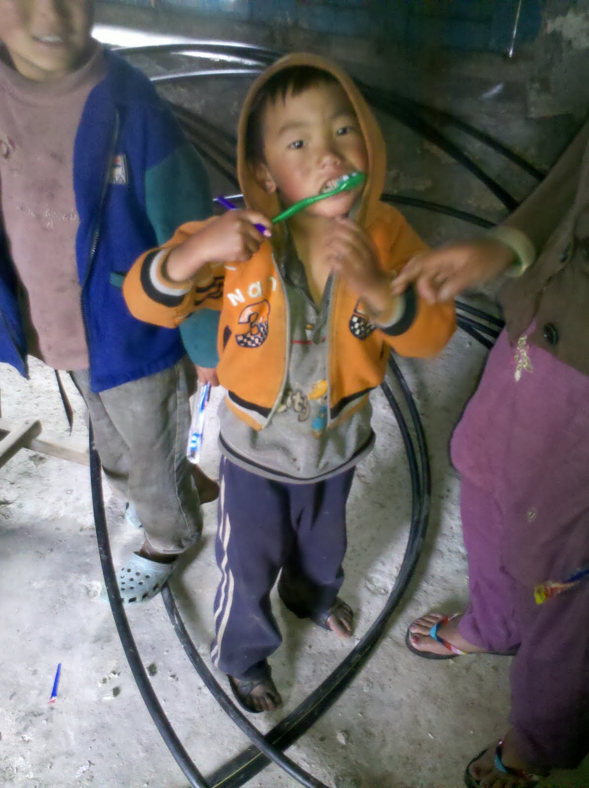
Despite obvious shaky distractions, we still managed to squeeze in some training with Tenzing (the healthcare worker in Ghunsa), and Lamu (the midwife). Main things we discussed were antenatal care, identifying high risk pregnancies, post-partum management and children's health. There are various issues specific to Ghunsa, for example iodine deficiency, general nutritional deficiencies, and a high rate of anaemia, which is compounded by the fact that Ghunsa is at 3500m and there is a little less oxygen floating around. The main problem however is lack of access to hospital care- it is at least a 3 day walk out to the nearest road end, and a very understaffed and under-resourced hospital is found there. Hence the focus on preventive healthcare and identifying in advance which women need to deliver in hospital. At the end of last year a woman died after giving birth due to heavy bleeding, and her baby subsequently starved to death over the next 6 months. We discussed how each of these circumstances could be prevented were such a thing to happen again. Tenzing has recently completed 2 months of dental training, so we also took the opportunity to do some teaching with the kids about dental hygiene (which is pretty appalling in these parts).

Sunday, October 2, 2011

The Children of Foley

Some fresh photos of the children of Foley, as fundraising begins for the rebuilding of the preschool, school and health post destroyed in the 2011 Himalayan Earthquake.

Foley is a poor Tibetan refugee community ihttp://www.blogger.com/img/blank.gifn north eastern Nepal settled following the Chinese invasion of Tibet in the 1950's. It maintains trade routes to Tibet via Olangchungola and gets limited support from the Tibetan government in exile in Dharamsala. For the last twenty years it has been assisted in educating its children by the Kanchanjunga School Project.

The "Sikkim" Earthquake

Just reading about the earthquake we just escaped. The 2011 "Sikkim" Earthquake was actually centred in Eastern Nepal, right on our tent flaps, as our friend Lara observed. Here is a map from the USGS...

And here is a description of the geology of the quake from Wikipedia:

The magnitude 6.9 (Mw) earthquake occurred inland at 18:10 IST on 18 September 2011, about 68 km (42 mi) northwest of Gangtok, Sikkim at a shallow depth of 19.7 km (12.2 mi).[3] At its location, the continental Indian and Eurasian Plates converge with one another along a tectonic boundary beneath the mountainous region of northeast India near the Nepalese border. Although earthquakes in this region are usually interplate in nature, preliminary data suggests the Sikkim earthquake was triggered by shallow strike-slip faulting from an intraplate source within the over-riding Eurasian Plate. Initial analyses also indicate a complex origin, with the perceived tremor likely being a result of two separate events occurring close together in time at similar focal depths.[1] Located at a shallow depth beneath the surface, the earhttp://www.blogger.com/img/blank.gifthquake caused strong shaking in many areas adjacent to its epicenter reportedly lasting 30–40 seconds.[10][non-primary source needed] The strongest shaking occurred to the west in Gangtok and further south in Siliguri, although similar ground motions registering at MM VI (strong) on the Mercalli scale were recorded in many smaller towns such as Mangan across elevated regions. Lighter tremors (MM IV–III) spread southward through populous regions, with these motions reported in the Patna capital of Bihar and as far southwest as Bihar Sharif.[2] In all, the earthquake was felt in Nepal, India, Bhutan, Bangladesh and China. Tremors were felt in Assam, Meghalaya, Tripura, parts of West Bengal, Bihar, Jharkhand, Uttar Pradesh, Rajasthan, Chandigarh and Delhi states of India.[11] In Tibet, the earthquake was felt in Shigatse and Lhasa.[12]

Here is a good blog detailing the earthquake from the Sikkim (Indian)perspective with some great pictures

From the Nepali side what is most remarkable is the fortune of the mountain communities in what was a very strong shake. Firstly the quake occurred at 6.10pm when nearly everyone was inside preparing dinner. Secondly the houses are largely built of timber (and virgin rainforest timber at that). They also have a rectangular interlocking design which seems very earthquake proof. In the limited places where this design was not followed or these materials were not available there was serious damage. It is also clear that the communities have a recognition of the dangers of rockfalls (and presumably avalanches) and older villages are sited in safe places (this may not be the case for newer houses, eg those developed as trekking tea houses).

A wooden house split open in Ghunsa, perhaps not quite adhering to the traditional design concepts?

Kambachen, well above the tree line and largely built of stone...devastated...

Amjilosa, a house built for teahouse trekking, unsafe below a vast weedy slope, the consequences of slash and burn agriculture

The long term consequences of the quake for the people of the district around Ghunsa is that they will have to live with ongoing objective danger along their main connection with civilisation the Ghunsa khola (river). Rockfall is a real danger at hundreds of places between Lelep and Lhonak with especially dangerous slips immediately below each of Lhonak, Kambachen, Ghunsa, Foley and Gyabla. It is likely more use will be made of the yak route between Gyabla and Olangchungola and of the eastern route over Mirgin La which is largely free of earthquake damage. Despite this the danger of future casualties in the valley from rockfall are very high.

A few examples of earthquake damage in the Ghunsa Khola:

One fine day - One good photo

Penny, Jamie and Mt Kanchenjunga -The 3rd highest mountain in the world.