Thursday, January 19, 2012

Everest - Checking out the Big guy

So we were up at Lobuche, in the Dudh Kosi valley, killing some time while waiting for the New Zealand summer to begin. It was cold, especially at night, and the yak dung smoke itched at the back of your throat like a furry carpet. The air itself, cold and stripped of moisture, tears at the furry carpet like a vacumn cleaner. The western food, carried in for days and prohibitively expensive, stares at us, daring us to splurge. The Nepalese food comes to us in ever decreasing volumes, just as we need the energy we are gradually bled dry. Bottled water is too expensive and the batteries for our UV filter don't work when it is this cold. Giant yaks shit in the streams constantly. Purged we dragged our butts up to Everest base camp, or at least the moraine wall above it, where there is some pretty mountain scenery.

Pumo-Ri with the viewpoint of Kala Pattar below

Looking up valley to some mountains

First glimpse of Everest for the day

One person forgot the camoflague tent rules for base camp.

This is Lhotse in the centre - Everest is obscured by the peak on left - Khumbu icefall!


The scenery really got cranking though when we headed up Kala Pattar like everyone does now. Many go up for sun-rise, but we had heard this was cold and over-rated. We were pleased to be there in the middle of the afternoon. Sam was like a model, posing with any mountain (read celebrity) he could wrap his arm around. Penny wasn't much better. The whole thing really was a big relaxed mountain love-fest.


And yeah aside from those ugly mugs there was actually a nice view. To go with my collage fetish, here is the beginning of my panorama obsession. Not sure what it looks like full size as it has been heavily reduced for the web....but what a massif!


Wednesday, January 18, 2012

Wandering Towards Everest

It wasn't really our intention when going to Nepal to join the multitudes on the path to Everest Base Camp. It just sort of worked out that way; GB's village was close by and you know it was just there. It was an awesome surprise to find that there are so many options in this area to get off the beaten track and knock around a bit on easy terrain well above 5000metres. We chose the well-known "Three Passes" route, which swerves around amongst the hills and valleys below Everest. The aerial representation below shows our route as far as the Gokyo valley.


Namche Bazar must be one of the most famous villages in the world. There is something about its setting , sheltered in a snug ampitheatre from the mighty mountains around it, that sticks in the memory. It helps of course that Mt Everest is just up the valley and that Namche is the capital of the famous Sherpa people. Tourism has brought plenty of wealth to many Sherpas, the richest control trekking or guesthouse empires and live in grand houses in Kathmandu. Everyone is in on the act, guesthouses litter the track like discarded snickers bar wrappers, and Namche has grown to accomodate our western consumer needs. A lovely spot, but we passed through quickly heading for a guesthouse on the track near Khumjung.

Sam and Penny getting out of Namche in a hurry

And contemplating the massiveness of Thamserku

First sighting of Ama Dablam (right) and Everst (pyramid just left of centre)
The majesty of Ama Dablam - from our guesthouse in Khumjung


If Namche is the hub and commercial centre of the Sherpa people, the hidden valley of Khunde and Khumjung is their heart and soul. These were the villages that Sir Edmund Hillary fell in love with and centred his lifes work around. We went for a morning stroll around the villages, feeling uplifted without our packs on a beautiful morning with amazing views all around.


 That day we headed on up the valley as far as Pheriche taking the track up the western side of the Dudh Koshi, through the awesome little village of Phortse which we really loved. We only saw a handful of tourists the entire day including a couple of English (I think) Doctors who had been manning (womanning?) the clinic at Pheriche for the last few months. They were wearing MACPAC's and it turns out they are based during the winters at Whakapapa skifield. Walking past Phortse we got a great view across the valley to Tengboche and the vast face of Thamserku behind. At one point we spotted a little herd of Himalayan Thar happily feeding on a small spur...not quite as persecuted as those that roam the Southern Alps.

Harvesting time in Phortse

Prayer stone amidst the potato fields

Phortse with Pharilapche behind

Himalayan Thar browse on spur - Tengboche in background
We arrived in Pheriche just after dusk, coughing our way into the yak dung powered settlement which sits in the valley floor and suffers an unfortunate inversion layer given the circumstances. We stayed in a lovely guesthouse which had an improvised wood-burner in the middle of the common room, this was to become standard and necessary over the next week or so. We were now at 3810metres altitude and it was getting pretty damn cold at night. From Pheriche we branched off from the main track and headed right up the Imja Khola in the direction of the well known "trekking peak" Island Peak and the high passes that lead to the Makalu area. We only went up valley as far as the guesthouses of Chukkung before hanging a left and crossing Kongma La back to the Dudh Koshi. This is a terrifically scenic area with views of Ama Dablam and surrounding mountains, Makalu, Lhotse and from the Kongma La itself, endless mountains to the west. Quite possibly the scenic highlight of our entire five month holiday!

A white wall above Chukkung

Ama Dablam towers above Chukkung
Sam begins the long climb to Kongma La
The Nuptse to Lhotse ridge blocks out a view of Everest

Penny has her day of suffering - this was steeper than it looks

What can you say about that mountain!

Nearing the top - Makalu appears in the centre background. Makalu is the 5th highest mountain in the world. On our trip we saw 8 of the ten highest mountains.


Penny with a few steps to go, pass at 5535metres

At the top looking west, Arakam Tse on left, Rolwaling dead centre in the distance, Lobuche glacier coming down to join the Khumbu

The crew, looking back the way we had come, Penny and her ginger beard men
The descent back the Khumbu was relatively quick, tho we couldn't say the same for the dubious scramble across the groaning glacier, where loose rock and yawning ice ponds gave us something different to think about. But what a day, next: on to Everest.


Monday, January 9, 2012

Towards the High Mountains

I have been somewhat reticient in blogging about our recent trip to the Solu-Khumbu, though Penny previously put up a post focussed on the educational work she was doing. In November we trekked for a month in this region: first in the agricultural foothills of the Solu, then in the high mountains of the Khumbu. This part of Nepal is wellknown in New Zealand for its association with the work of Sir Edmund Hillary. Hillary not only built schools for the Sherpas of the Khumbu, he built them for the much more populous Rais and Chetris of the Solu. We saw evidence of his work in towns like Phaplu, Salleri and Bung.

Near Shivalaya to Sotag with our route in red

Our journey started in Shivalaya, a small town just beyond Jiri on the bus. We walked from here to the Solu capital Salleri, then the village of Deusa over the Lamajura La - 2000 metres of grunt. A memorable stop towards the top of the pass was Goyam, where we sculled back some of the ubiqutous sugary tea and interacted with the locals.

Sam reveals he is as soft as a marshmallow deep inside
Most of the tourists we encountered were very ragged looking people walking out from the Everest region, often after been stuck in Lukla for several days with no flights in prospects. The unreliability of Lukla airport due to weather conditions in peak trekking season seems to be one of the great secrets of the tourism world. This last season there were two periods of other nine days where no plane flights were possible - the helicopter companys must mae a killing. The journey through the vast landscape of terraced fields and villages was amazing, there were many monasterys and people to take photos of, and not a tourist in sight.

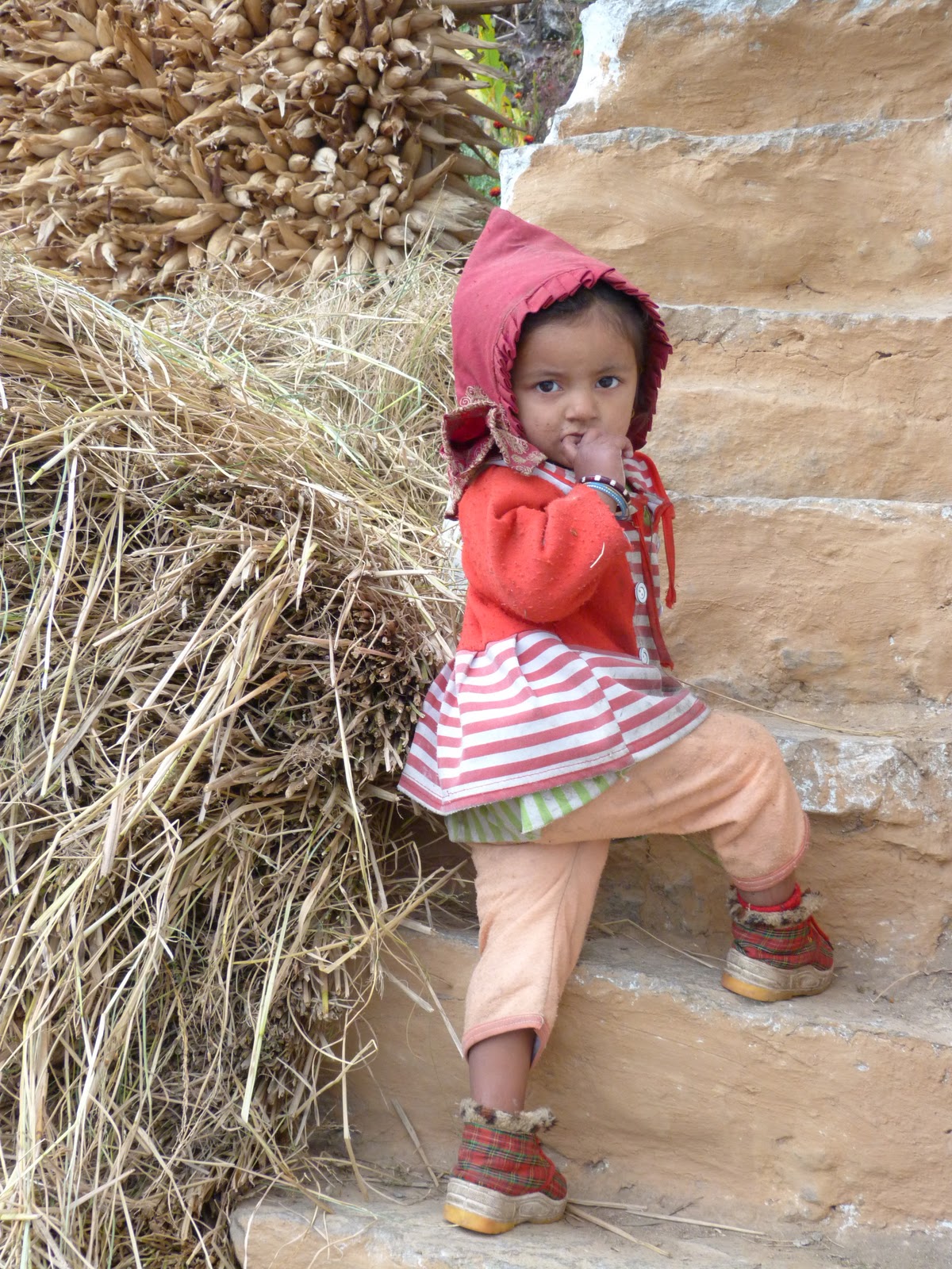
Curious kids...
 In Deusa, while Penny was working, Sam and I chilled out, read books and explored the local environment. One day we headed down to the Dudh Kosi, a thousand metre descent from the village which is perched on a ridge. This is the river that flows from Everest, that we were soon to explore the headwaters of. Giant swing bridges, cross the river providing vital highways for the porters that service these remote communities, we met some locals on our travels, including students heading back into their villages for the holidays.


After a week in Deusa, we headed onto Sotang, the home village of GB, our guide from Kanchenjunga. It was amazing to visit GB's family home and live with them for a while and begin to understand Nepali village life. It is a world so removed from our own. Like all agricultural societies their day to day activity is so dependant on the weather, and while we were there it was raining during harvest and cut rice lay rotting on the fields. Another noticeable feature was the amount of young people. The small ridge of Sotang supports a population of over ten thousand and a high school of over 1000kids, studying in two shifts.

Images from Sotang
GB lives with his parents, sister-in-law and niece. His wife and children live 7 hours walk away with his wife's parents, while his brother in law lives in America, other brothers are in the Nepalese army and Afgahnistan. We found it common in Nepal that men would often spend many years out of country, generally in the Gulf states, a sad state of affairs for family life.

GB's niece
Penny has described her medical experiences in Sotang in a somewhat understated manner. Quite what you do when you have a 45year old mother of five, one of who was born 30 minutes ago in the toilet, with a placenta refusing to come out in an ill-equipped medical clinic in the middle of nowhere is hard to imagine. Penny attempted a manual retrieval, all the while having to explain this to and educate the local midwifes and healthcare workers. Unfortunately this wasn't possible and there was no other option than the family carrying her 12 hours to the nearest airport and hoping for a flight to Kathmandu. There were helicopters constantly overhead ferrying tourists to and from the Everest region at a cost the locals, even in life threatening situations, couldn't comprehend. Sam and I were much less constructively engaged, mooching around, eating the town out of samosas and watching BBC at the fanciest guesthouse in town. We did get away for one little walk which ended up with crashing in a monastery and befriending a trainee monk. The locals seemed to like us, they were perhaps a little over-grateful showering even the moochers with flowers, coloured rice and the like when we eventually left. Here's an amusing team photo.

Fresh from a tikka ceremony

But leave we did, and some walking we had to do, from Sotang in the foothills to Lukla, Namche Bazaar and on to the Three Passes trip in the valleys around Everest. The picture below shows our route as far as Namche.

Sotang to Namche Bazaar

It was sad to leave Sotang, and especially GB, who came with us for half a day to guide us on the small trails across the giant valley of the Hinku Khola. We are talking big hills around here, 1500 metres roughly from river to ridge top. It was only one long day from Sotang to where we hit the Everest trail at Kharikhola.

Sam crosses the Hinku khola to the delights of the Everest trail
 We were back on the main path, in the land of copious guesthouses, porters and expensive cokes. But there was still some walking to be done. It is a grind from Kharikhola up to Lukla and we ground it out, stepping aside occasionally to give way to mules, yaks and the occasional Everest trail runner. We actually avoided Lukla taking the low route and saving the Starbucks for the way back through. Briefly we were caught in a mad rush of tourists but largely it was a pretty quiet stroll up to Namche, with the odd pretty mountain or swingbridge or chorten or mani wall or yak or stream catching the eye. Next Everest blog - Pass 1: The Kongma La.

Penny trail wandering


Korokoro


I finally got out to my favourite run in Wellington - Belmont Trig via the Korokoro gorge. As soon as you head up the gorge from Petone the bush closes in and you feel miles away from the world. The track is just such a nice track to run on, the first few km's is flat by Wellington standards. Up towards Baked beans bend there are a few river crossings which I just crashed through today. The river was too high to think about staying dry. The hill as ever was a good challenge, 456metres above where I started at sea-level, and then back down along the farm track and slippery tawa groves. At the end to avoid going back to the Korokoro rail crossing I waded down the stream under the motorway, a fun little end to the run.

Near the start of the run, on the western side of the motorway near the Korokoro hill I came across the grave, or at least memorial for, for this man. It was in a lonely corner of a reshaped park. Wi Tako was a Maori leader during the pakeha  colonisation of Wellington, who at least partly began the forging of the dominant Love family in the Wellington region, here is the whakapapa from the famous pacifist Te Whiti o Rongomai to contemporary leader Sir Ngatata Love, complete with the odd whaler thrown in.

Sunday, January 8, 2012

Phewa lake - Boating in Nepal


Posted by Picasa I never thought I would have a tea-bagger for a brother;-)

Saturday, January 7, 2012

An update

I have finally completed the blog from our family trip to the Lower Mustang

This was definitely one of the highlights of our entire trip, an arid landscape stuck between the himalaya and the Tibetan plateau, which has been a thoroughfare since ancient times.

Now I will be able to start chucking up some more photos from our Nepal trip - we did actually see some pretty nice mountains.

Tuesday, January 3, 2012

Ngaruhoe jog

The O-Gang and friends went for a jog up Ngaruhoe and Tongariro the other day after a couple of days cooped up by rain. Crazy cool place which just seems to get smaller the older I get. The highlight was definitely the fast descent of Tongariro's west ridge.
On the left - team photo, on the right - Lizzie, Penny and Imogene jog towards the summit of Tongariro.